


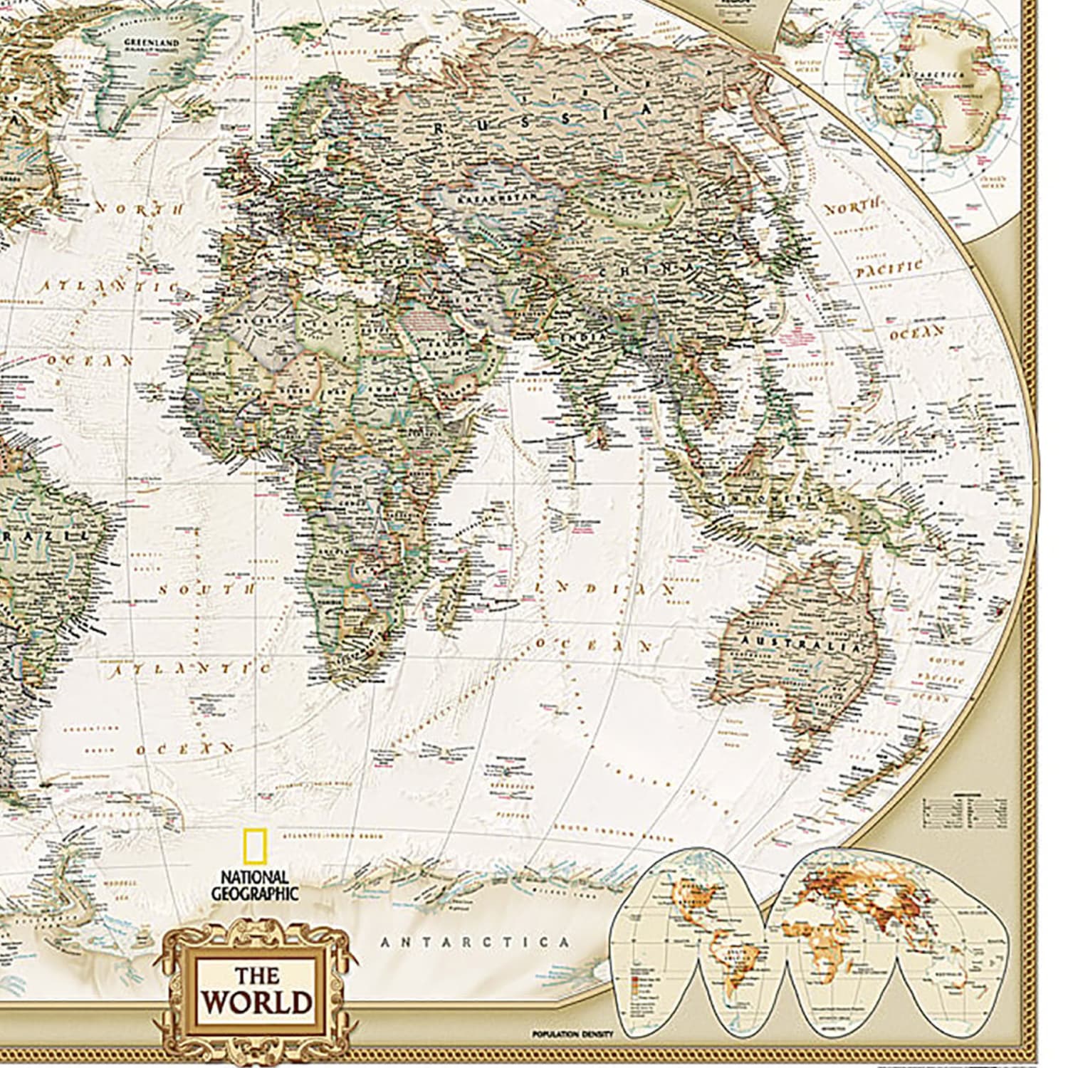
National Geographic World Executive Map, Mural, 110in x 76.5in
Original price was: $146.99.$127.82Current price is: $127.82.
Buy More and Save with Volume Discount:
| Quantity | 2 + | 5 + | 10 + |
|---|---|---|---|
| Price | $127.69 | $127.56 | $127.44 |
11 in stock
- Orders placed by 2pm ship within 24–48 hours.
- Free shipping on orders $65 and over.
- Typical transit time: 2–3 business days.
Expertly researched and designed, National Geographics World Wall Map is the authoritative map of the world by which other reference maps are measured. Antique-style “executive” color palette.
- Background shows mountain ranges and valleys in subtle shaded relief with mountain ranges labeled.
- Major water bodies including rivers, lakes, glaciers, oceans, seas, gulfs, bays, straits, and bathymetry.
- Clearly defined international boundaries, cities, islands, airports, and physical features.
- Thousands of place names carefully and artfully placed to maintain legibility in heavily populated areas.
- Up-to-date international boundaries and territorial control reflect de facto status on the ground.
- Meticulously researched using multiple authoritative sources including the U.N., U.S. Board on Geographic Names, and policies of individual governments.
- Accurate place names use a combination of conventional English names, official national names, and standard transliterations for non-Latin alphabets.
- Drawn in Winkel Tripel projection with distortions minimized unlike other World maps (e.g. Greenland is shown the same size as Argentina, not South America).
- Corner inset maps feature vegetation, land use, population density, and north and south polar regions.
- Mural maps are printed on a tear-resistant, coated paper for strength, color protection, and long life.
- The coating resists dirt and dust and may be cleaned with a slightly dampened cloth.
- The mural can be hung using heavy duty (clay based) wallpaper paste.
- Measures 110in x 76.5in.
| Weight | 2.75 lbs |
|---|---|
| Dimensions | 38 × 5.25 × 4.5 in |
Related products
Classroom Teaching Resources
Classroom Teaching Resources
Classroom Teaching Resources

Classroom Teaching Resources
The Original E-Z Grader Large Print Slide Charts, Blue, Pack Of 3

Classroom Teaching Resources
Carson-Dellosa Brighter Child Handwriting Workbook: Printing, Ages 5 – 7

Classroom Teaching Resources
Scholastic Teacher Resources Weekly Reader Workbook: Summer Express, Grades K 1

Classroom Teaching Resources
Scholastic Week-by-Week Homework For Building Reading Comprehension & Fluency – Grades 2-3
Classroom Teaching Resources